20 Best yachting & sailing iOS Apps1) Therapy Yachting Browse our fleet, check for available bookings and get ready for a unique experience with one of Therapy Yachting`s sailing boats.Powered by frenzy.projects (Free)By Pantelis Peslis via 2) Yachting World Magazine International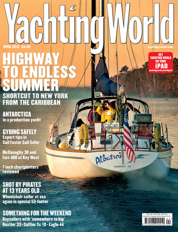 Yachting World is world`s leading international yachting magazine. From ocean racing and blue water cruising to the most glamorous super-yachts, Yachting World has the very best in nautical writing and stunning photography, with up-to-the-minute technical reports, race analysis, new boat tests and much more. (Free)By IPC Media Limited via 3) ADSYC Abu Dhabi Sailing & Yacht Club established in 2011 to serve as the new home of modern & traditional Sailing in Abu Dhabi. The club hosts events on the local, regional & international level to further the development of sailing in Abu Dhabi. ADSYC is the home of a large variety of watersports including dhow sailing, yachting, dinghy sailing, surfing, rowing & kayaking. (Free)By adsyc dev via 4) Yachting NZ app Yachting New Zealand mobile application will provide additional value to Yachting New Zealand affiliated clubs and their members. The app is free for all affiliated clubs and their membership. Only registered members will receive the exclusive Membership benefits from Yachting New Zealand partners. This app will be a useful tool to keep all Yachting New Zealand members informed of developments and ongoing activity. (Free)By Chris Milicich via 5) Netherlands nautical chart gps: marine & lake waypoint, route and track for boating cruising fishing yachting sailing diving MapITech launch and brings on market the Best official up-to-date NOAA nautical charts, boat ramps Marinas, wrecks, fishing spot, POI.The interactive men is very intuitive, the maps are downloaded on the device itself, it works in OFFLINE mode.The power of the professional GPS - Chart plotter at a minimal cost.At a glance:Powerful searchKML data shareableVery detailed chartsWaypointsMarkers & FavoritesMultiple tracksGeo - tagged photo managementDistance MeasureCompassGPS window with very detailed infoUser friendly on latest IOS 7Continued use of GPS running in the background can decrease battery life. This only apply if background recording is enabled. ($5.99)By MapITech via 6) Ireland nautical chart gps: marine & lake waypoint, route and track for boating cruising fishing yachting sailing diving MapITech launch and brings on market the Best official up-to-date NOAA nautical charts, boat ramps Marinas, wrecks, fishing spot, POI.The interactive men is very intuitive, the maps are downloaded on the device itself, it works in OFFLINE mode.The power of the professional GPS - Chart plotter at a minimal cost.At a glance:Powerful searchKML data shareableVery detailed chartsWaypointsMarkers & FavoritesMultiple tracksGeo - tagged photo managementDistance MeasureCompassGPS window with very detailed infoUser friendly on latest IOS 7Continued use of GPS running in the background can decrease battery life. This only apply if background recording is enabled. ($12.99)By MapITech via 7) England nautical chart gps: marine & lake waypoint, route and track for boating cruising fishing yachting sailing diving FULL (UK-IRELAND) NAUTICAL CHARTS COVEREDMapITech launch and brings on market the Best official up-to-date NOAA nautical charts, boat ramps Marinas, wrecks, fishing spot, POI.The interactive men is very intuitive, the maps are downloaded on the device itself, it works in OFFLINE mode.The power of the professional GPS - Chart plotter at a minimal cost.At a glance:Powerful searchKML data shareableVery detailed chartsWaypointsMarkers & FavoritesMultiple tracksGeo - tagged photo managementDistance MeasureCompassGPS window with very detailed infoUser friendly on latest IOS 7Continued use of GPS running in the background can decrease battery life. This only apply if background recording is enabled. ($19.99)By MapITech via 8) Texas nautical chart HD: marine & lake gps waypoint, route and track for boating cruising fishing yachting sailing diving MapITech launch and brings on market the Best official up-to-date NOAA nautical charts, boat ramps Marinas, wrecks, fishing spot, POI.The interactive men is very intuitive, the maps are downloaded on the device itself, it works in OFFLINE mode.The power of the professional GPS - Chart plotter at a minimal cost.At a glance:Powerful searchKML data shareablevery detailed chartsWaypointsMarkers & FavoritesMultiple tracksGeo - tagged photo managementDistance MeasureCompassGPS window with very detailed infoUser friendly on latest IOS 7Continued use of GPS running in the background can decrease battery life. This only apply if background recording is enabled. ($5.99)By MapITech via 9) Hawaii nautical chart HD: marine & lake gps waypoint, route and track for boating cruising fishing yachting sailing diving MapITech launch and brings on market the Best official up-to-date NOAA nautical charts, boat ramps Marinas, wrecks, fishing spot, POI.The interactive men is very intuitive, the maps are downloaded on the device itself, it works in OFFLINE mode.The power of the professional GPS - Chart plotter at a minimal cost.At a glance:Powerful searchKML data shareablevery detailed chartsWaypointsMarkers & FavoritesMultiple tracksGeo - tagged photo managementDistance MeasureCompassGPS window with very detailed infoUser friendly on latest IOS 7Continued use of GPS running in the background can decrease battery life. This only apply if background recording is enabled. ($5.99)By MapITech via 10) Georgia nautical chart HD: marine & lake gps waypoint, route and track for boating cruising fishing yachting sailing diving MapITech launch and brings on market the Best official up-to-date NOAA nautical charts, boat ramps Marinas, wrecks, fishing spot, POI.The interactive men is very intuitive, the maps are downloaded on the device itself, it works in OFFLINE mode.The power of the professional GPS - Chart plotter at a minimal cost.At a glance:Powerful searchKML data shareablevery detailed chartsWaypointsMarkers & FavoritesMultiple tracksGeo - tagged photo managementDistance MeasureCompassGPS window with very detailed infoUser friendly on latest IOS 7Continued use of GPS running in the background can decrease battery life. This only apply if background recording is enabled. ($5.99)By MapITech via 11) Maine nautical chart HD: marine & lake gps waypoint, route and track for boating cruising fishing yachting sailing diving MapITech launch and brings on market the Best official up-to-date NOAA nautical charts, boat ramps Marinas, wrecks, fishing spot, POI.The interactive men is very intuitive, the maps are downloaded on the device itself, it works in OFFLINE mode.The power of the professional GPS - Chart plotter at a minimal cost.At a glance:Powerful searchKML data shareablevery detailed chartsWaypointsMarkers & FavoritesMultiple tracksGeo - tagged photo managementDistance MeasureCompassGPS window with very detailed infoUser friendly on latest IOS 7Continued use of GPS running in the background can decrease battery life. This only apply if background recording is enabled. ($5.99)By MapITech via 12) Louisiana nautical chart HD: marine & lake gps waypoint, route and track for boating cruising fishing yachting sailing diving MapiTech launch and brings on market the Best official up-to-date NOAA nautical charts, boat ramps Marinas, wrecks, fishing spot, POI.The interactive men is very intuitive, the maps are downloaded on the device itself, it works in OFFLINE mode.The power of the professional GPS - Chart plotter at a minimal cost.At a glance:Powerful searchKML data shareablevery detailed chartsWaypointsMarkers & FavoritesMultiple tracksGeo - tagged photo managementDistance MeasureCompassGPS window with very detailed infoUser friendly on latest IOS 7Continued use of GPS running in the background can decrease battery life. This only apply if background recording is enabled. ($5.99)By MapITech via 13) Delaware nautical chart HD: marine & lake gps waypoint, route and track for boating cruising fishing yachting sailing diving MapiTech launch and brings on market the Best official up-to-date NOAA nautical charts, boat ramps Marinas, wrecks, fishing spot, POI.The interactive men is very intuitive, the maps are downloaded on the device itself, it works in OFFLINE mode.The power of the professional GPS - Chart plotter at a minimal cost.At a glance:Powerful searchKML data shareablevery detailed chartsWaypointsMarkers & FavoritesMultiple tracksGeo - tagged photo managementDistance MeasureCompassGPS window with very detailed infoUser friendly on latest IOS 7Continued use of GPS running in the background can decrease battery life. This only apply if background recording is enabled. ($5.99)By MapITech via 14) Florida nautical chart HD: marine & lake gps waypoint, route and track for boating cruising fishing yachting sailing diving MapiTech launch and brings on market the Best official up-to-date NOAA nautical charts, boat ramps Marinas, wrecks, fishing spot, POI.The interactive men is very intuitive, the maps are downloaded on the device itself, it works in OFFLINE mode.The power of the professional GPS - Chart plotter at a minimal cost.At a glance:Powerful searchKML data shareablevery detailed chartsWaypointsMarkers & FavoritesMultiple tracksGeo - tagged photo managementDistance MeasureCompassGPS window with very detailed infoUser friendly on latest IOS 7Continued use of GPS running in the background can decrease battery life. This only apply if background recording is enabled. ($4.99)By MapITech via 15) Michigan nautical chart HD: marine & lake gps waypoint, route and track for boating cruising fishing yachting sailing diving MapiTech launch and brings on market the Best official up-to-date NOAA nautical charts, boat ramps Marinas, wrecks, fishing spot, POI.The interactive men is very intuitive, the maps are downloaded on the device itself, it works in OFFLINE mode.The power of the professional GPS - Chart plotter at a minimal cost.At a glance:Powerful searchKML data shareablevery detailed chartsWaypointsMarkers & FavoritesMultiple tracksGeo - tagged photo managementDistance MeasureCompassGPS window with very detailed infoUser friendly on latest IOS 7Continued use of GPS running in the background can decrease battery life. This only apply if background recording is enabled. ($5.99)By MapITech via 16) California nautical chart HD: marine & lake gps waypoint, route and track for boating cruising fishing yachting sailing diving MapiTech launch and brings on market the Best official up-to-date NOAA nautical charts, boat ramps Marinas, wrecks, fishing spot, POI.The interactive men is very intuitive, the maps are downloaded on the device itself, it works in OFFLINE mode.The power of the professional GPS - Chart plotter at a minimal cost.At a glance:Powerful searchKML data shareablevery detailed chartsWaypointsMarkers & FavoritesMultiple tracksGeo - tagged photo managementDistance MeasureCompassGPS window with very detailed infoUser friendly on latest IOS 7Continued use of GPS running in the background can decrease battery life. This only apply if background recording is enabled. ($5.99)By MapITech via 17) New Jersey nautical chart HD: marine & lake gps waypoint, route and track for boating cruising fishing yachting sailing diving MapITech launch and brings on market the Best official up-to-date NOAA nautical charts, boat ramps Marinas, wrecks, fishing spot, POI.The interactive men is very intuitive, the maps are downloaded on the device itself, it works in OFFLINE mode.The power of the professional GPS - Chart plotter at a minimal cost.At a glance:Powerful searchKML data shareablevery detailed chartsWaypointsMarkers & FavoritesMultiple tracksGeo - tagged photo managementDistance MeasureCompassGPS window with very detailed infoUser friendly on latest IOS 7Continued use of GPS running in the background can decrease battery life. This only apply if background recording is enabled. ($5.99)By MapITech via 18) Yachting HD Yachting the first and the most influential Russian magazine about luxury motor and sailing yachts and boats, travel destinations and prestigious sail regattas, lifestyle, people and events, presents the first Yachting iPad application in Russian. With its exclusive reviews of the newest and most beautiful, modern and breathtaking custom and production yachts in the world, supplied with most colorful pictures and video, it is very interactive, easy to navigate and seductive (Free)By VERIMAG, LLC via 19) iTrim - english version Whether during charter trips or on your own sailing yacht - with iTrim your sail trimm ist perfect. Enter the wind and sea conditions and the trimm computer calculates the correct feathered of the genua and the main sail, as well as the sheet and traveller setting on your iPhone or iPod Touch.With iTrim you are one step ahead of your fellow sailing mates.Perfect for beginners and pros.iTrim is also available in german language.Themes: Sailing, Yacht, yachting, Sailboat, Skipper ($0.99)By Ralf Andrae via 20) Navionics Boating: marine & lakes charts, routes, GPS tracks for cruising, fishing, yachting, sailing, diving. The worlds top selling boating apps. For boaters, fishermen and all water sports enthusiasts Navionics Boating is the newest app by Navionics Get the same great detail you have on your GPS chartplotter Download for free Then select and purchase the coverage options you prefer. In addition, advanced features like Nav Module, Autorouting and Advanced Map Options are available on all regions purchased. More value and cheaper You can add more world regions if needed anytime, they will merge seamlessly, all-in-one.CHARTSOur charts are award winning vector maps allowing to query chart objects anytime for descriptive details. Furthermore pan, zoom and ... (Free)By Navionics via
|
|